
REVIEW · SEDONA
Secret Wilderness (45+ Mile) – Sedona Helicopter Tour
Sedona’s red-rock country makes the most sense from the air. This 30 to 32-minute flight covers roughly 45 miles of scenery, from Bell Rock and Cathedral Rock to Secret Canyon, Oak Creek Canyon, and cliff dwellings tucked into the stone. You get views that long hikes and busy roads simply cannot provide.
I like the small aircraft and forward-facing seats, which give every passenger a clear view. I also like the personal feel: pilots such as Joshua and Steve handle the flight while explaining the rocks, trails, wildlife, and ruins below. The main drawback is the price, $438.30 per person, and poor weather can force a cancellation or change of date.
Key points to know
- See Sedona from above in 30 to 32 minutes, covering a wide sweep of red-rock country.
- Fly close to Cathedral Rock, Bell Rock, Courthouse Butte, Devil’s Bridge, and other famous sights.
- Reach Secret Canyon and Bear Sign Canyon by air, areas that require extensive hiking from the ground.
- Spot ancient Sinagua cliff dwellings near Boynton and Long Canyons.
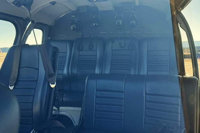
- Travel in a small helicopter with noise-reducing headsets and forward-facing seating.
- Plan for weather flexibility, since the flight requires suitable conditions and offers a refund or new date if canceled.
A fast way to understand Sedona’s red rocks
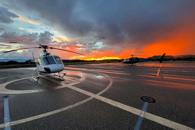
The tour leaves from Sedona Airport at 1225 Airport Road. The airport itself gives you a fine opening view over the town and nearby rock formations, and the same overlook frames the return before landing.
As the helicopter lifts off, you begin with Thunder Mountain, Coffee Pot Rock, Ship Rock, The Mitten, and The Sphinx. These names are easy to appreciate from the ground, but the air gives you a quick lesson in how each formation relates to the others.
That wider view is the real reason to book. From a trail, you see one cliff or butte at a time. From the helicopter, you see how the red-rock formations gather around Oak Creek, the canyons, and the town. You also spend less time getting from one sight to the next.
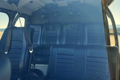
The aircraft has air conditioning, noise-reducing headsets, and microphones. Those headsets matter. Helicopter noise is strong, and without them, the pilot’s commentary would be hard to follow. All seats face forward, so you are not stuck looking across another passenger to see the view.
The tour is described as an intimate experience, with a maximum of six people. The highlight information also refers to a five-person group, so confirm the exact seating arrangement when booking if group size is important to you. In either case, this is much smaller than a large sightseeing flight.
More National Park Trips in the USA:
- ATV Tour of Lake Mead National Park with Optional Grand Canyon Helicopter Ride
★ 5.0 · 102 reviews - 55 Mile – Helicopter Tour Around Zion National Park
★ 4.5 · 73 reviews - Denali National Park: Helicopter Flight with Glacier Landing
★ 5.0 · 64 reviews
Cathedral Rock, Chapel of the Holy Cross, and Bell Rock
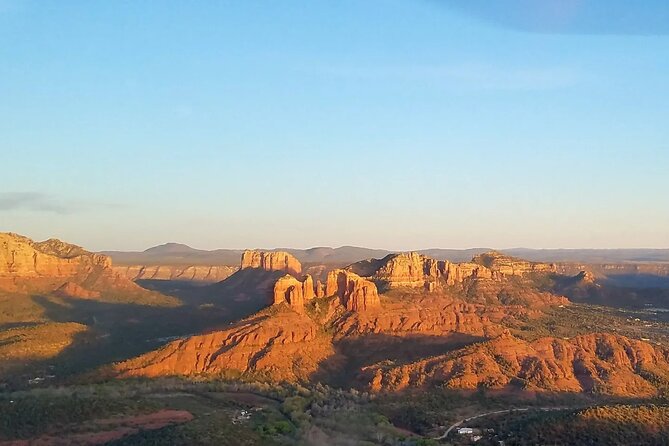
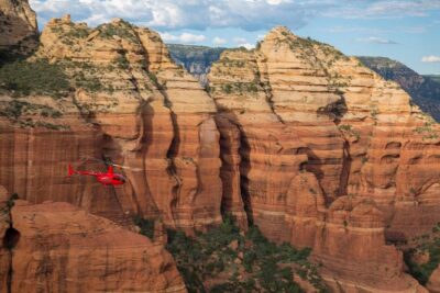
One of the most striking parts of the flight comes near Cathedral Rock. The helicopter brings you roughly level with the top of the formation, offering an angle that is not available from the usual viewpoints or trails.
As the aircraft rounds Cathedral Rock, you can see the Chapel of the Holy Cross and the formation called the Praying Hands. The chapel is a familiar Sedona landmark, but viewing it with the surrounding cliffs gives you a better sense of its setting.
The route then passes Red Rock State Park, with views toward Oak Creek, Schuerman Mountain, and Pyramid Rock. You get a good mix here: open red-rock views, green creek corridors, and layered ridges that are easy to miss when you stay near town.
Bell Rock is another major highlight. It is one of Sedona’s best-known hiking areas, and from above you can see its broad, rounded form without the crowds and trail junctions that shape a visit on foot. This is not a landing stop. The helicopter simply gives you time to look down and take in the full formation.
The route also passes Broken Arrow Trail, with views of the Praying Hands, Chicken Point, and Submarine Rock. If you have driven or hiked in this area, the aerial view helps connect those separate sights into one picture.
Courthouse Butte and the formations near Oak Creek
Courthouse Butte rises more than 1,000 feet and attracts rock climbers and base jumpers. From the helicopter, you get a clear sense of its size and steep sides. The view is brief, but the scale comes through better from the air than from a roadside pullout.
The flight continues past Snoopy Rock, the Tea Kettle, Eagle Rock, and the Cowpies. Sedona’s rock names can sound playful, but they serve a useful purpose. They give you easy reference points as the pilot describes the route, and they help you identify formations later during a drive or hike.
Grasshopper Point appears below as a popular swimming area. You also see Midgely Bridge, a graceful arch and an important landmark along Oak Creek Canyon. These smaller details keep the trip from becoming only a parade of famous rocks.
Wilson Mountain brings another change in scale. It is one of the hardest hikes in the area, and the aerial view includes Steamboat Rock, Ship Rock, and Oak Creek Canyon. You can see how much ground a difficult hike covers without spending a full day on the trail.
The route reaches the mouth of Oak Creek Canyon, where spring-fed Oak Creek runs year-round. From above, the creek provides a natural line through the rock. You can also see Ship Rock, the Fin, rock pillars, and seasonal waterfalls in the canyon.
Devil’s Bridge, Seven Canyons, and Thunder Mountain
The helicopter passes Devil’s Bridge, a natural stone bridge and one of Sedona’s most popular hikes. From the ground, reaching the bridge takes a hike. From the air, you get a view of the whole formation and the terrain around it in moments.
That does not replace the walk. If standing on Devil’s Bridge is a major goal, you still need time on foot. But the flight shows you the bridge’s shape and position in a way that a close-up trail view cannot.
You also pass Seven Canyons golf course. This is a quick sight, but it adds another point of reference between the developed areas and the more remote canyon country.
Near Thunder Mountain Trailhead, the view returns to Coffee Pot Rock, Soldiers Pass, The Mitten, and Sphinx Rock. The pilot can point out how these formations sit around the trail system. That is useful if you plan to hike later and want a better sense of direction.
The tour’s route is broad rather than slow and detailed at every point. You will see many named formations, but some pass quickly. If you want a close look at one particular rock, listen carefully and keep your camera ready. A helicopter flight rewards attention because the view changes every few seconds.
A few more helicopter tours around the USA worth a look
- New York City: Manhattan Helicopter Tour
★ 4.7 · 7,076 reviews - NYC: Manhattan Sightseeing Helicopter Tour
★ 4.8 · 5,826 reviews - Las Vegas Helicopter Night Strip Flight Tour with Optional Dinner
★ 4.5 · 5,693 reviews - Grand Canyon Village: Helicopter Tour & Hummer Tour Options
★ 4.7 · 2,586 reviews
Secret Canyon and Bear Sign Canyon from the air
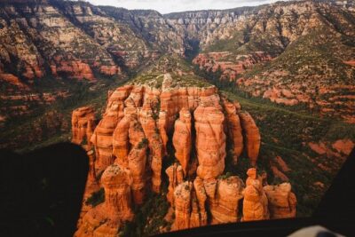
The most unusual section comes when the helicopter reaches Secret Canyon and Secret Mountain. These areas are accessible from the ground only by extensive hiking, so the flight gives you a look at remote country without committing to a long route on foot.
Bear Sign Canyon adds another wide panorama. Here, the value is not just the number of sights. It is the feeling of moving beyond the familiar Sedona viewpoints into quieter, less accessible country.
You should keep expectations realistic. This is an aerial visit, not a landing or a wilderness walk. You see the canyons from above and through the helicopter windows, with the pilot explaining what lies below. Still, for a short flight, this is one of the strongest reasons to choose the longer Secret Wilderness route.
The scenery also changes in texture. Near town, the formations are recognizable and heavily associated with trails, overlooks, and roads. In Secret Canyon and Bear Sign Canyon, the rock walls and folds feel more remote. The flight lets you compare both sides of Sedona in one outing.
Boynton Canyon and Sinagua cliff dwellings
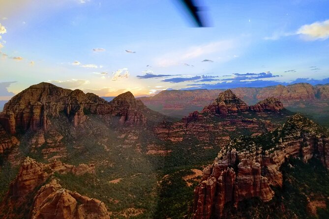
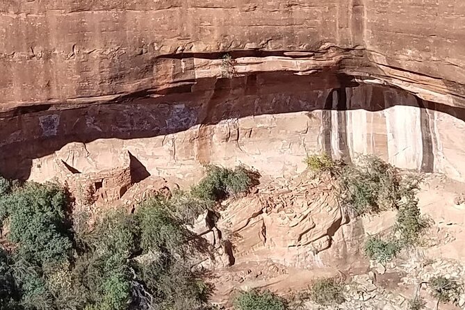
The helicopter moves into Boynton Canyon, one of the area’s most attractive canyon settings. Ancient Sinagua cliff dwellings appear in the rock walls, offering a glimpse of human history that is easy to miss from the usual roads.
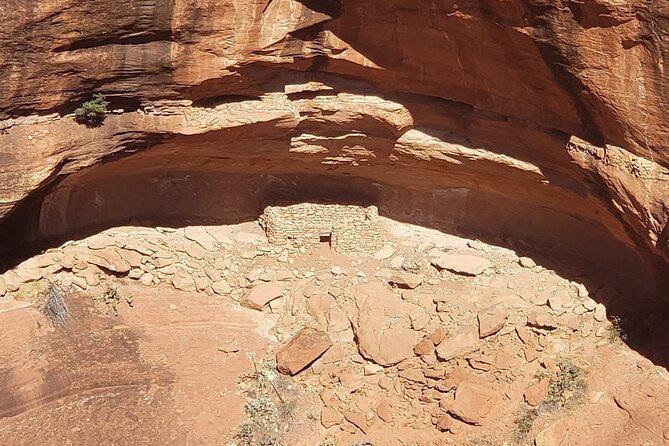
These dwellings are not presented as a walking stop, and you do not land to inspect them. Their value here comes from the angle. From above, you can see where they sit within the canyon and how the rock shelters fit into the larger setting.
Long Canyon lies next to Boynton Canyon, and the flight continues past more Sinagua cliff dwellings. Seeing both canyons in one pass helps explain why this part of Sedona has long drawn hikers, photographers, and people interested in the area’s earlier communities.
The helicopter also passes Mescal Mesa and the Birthing Cave. Mescal Mesa is a popular hiking area, while the cave has become a popular destination in its own right. Again, you get an aerial reference rather than a trail visit, but that reference can be useful if you are deciding which hikes deserve your limited time.
Doe Mountain follows. It is a good hike, especially later in the day, and its summit offers a broad view of the red rocks. From the air, you can see the mountain’s position and understand why the top is valued as a viewpoint.
The return over Chimney Rock and Schuerman Mountain
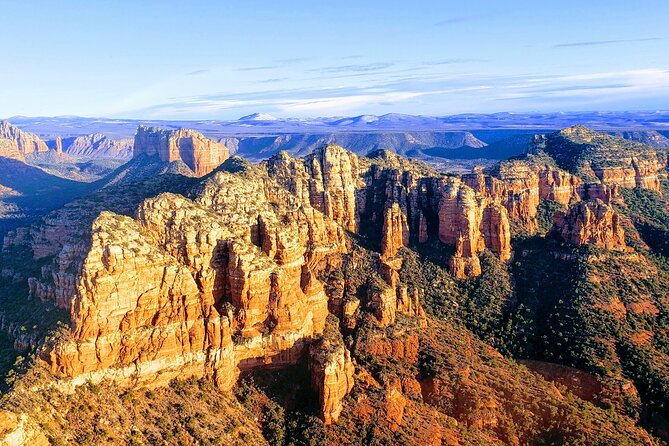
On the way back, the tour passes Lower Chimney Rock Trail. From above, Chimney Rock changes into the Three Fingers as the helicopter shifts its angle. This is a good example of why aerial viewing works so well in Sedona: formations can look completely different when you move only a short distance.
Schuerman Mountain appears again as the helicopter heads toward the airport. This final section brings together many of the sights from earlier in the flight, including Cathedral Rock, Bell Rock, Schnebly Hill, Ship Rock, Coffee Pot Rock, and Thunder Mountain.
That closing view is useful because you can finally place the major formations in relation to one another. You are not just looking at individual rocks. You are seeing the broad red-rock basin, canyon openings, creek corridors, and ridges around Sedona.
The airport landing brings you back to the same meeting point. The flight is short enough to fit into a busy Sedona day, but it covers enough ground to give you a strong overview before or after exploring on foot.
What the $438.30 price gives you
At $438.30 per person, this is a major splurge. You are paying for access to a small helicopter, a pilot who also serves as your guide, and a route that covers remote areas quickly. The cost makes more sense if you value time, panoramic views, and access to places that would require long hikes.
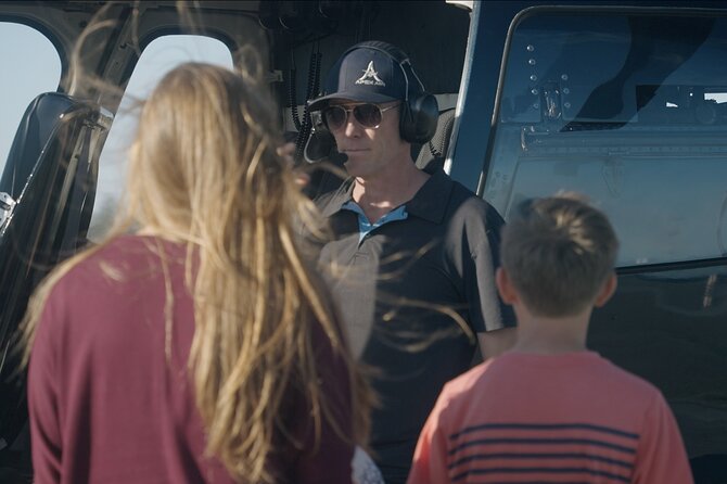
The flight also adds information to your visit. Pilots such as Joshua, Steve, and Josh have been praised for clear safety briefings, local knowledge, friendly conversation, and the ability to point out details below. One pilot even adjusted the route after spotting elk on a ridge, showing how the experience can respond to what appears in the air.
That personal commentary is a real advantage over a prerecorded narration. You can ask about a formation, a trail, or a canyon as it comes into view. The exact pilot varies, so do not book expecting a particular person unless Apex Air Tours confirms it.
The price is harder to justify if you mainly want a quick look at Cathedral Rock or Bell Rock. You can see both from the ground at no extra helicopter cost. This tour earns its value through the full route, the remote canyons, the ancient dwellings, and the amount of Sedona covered in half an hour.
Weather, weight, and practical planning
The flight requires good weather. If conditions cancel it, you can choose another date or receive a full refund. Because Sedona weather can change, avoid placing this tour at the very end of a short visit if seeing the area from the air is a top priority.
You can cancel for a full refund up to 24 hours before the scheduled start. Cancellations or changes made inside that window are not refunded or accepted. The experience also requires a minimum number of people, so a cancellation for that reason brings a new date, another experience, or a full refund.
The total weight limit is 400 pounds per passenger. Confirmation arrives at booking, and most people can participate. You should not fly if you are sick.
Bring your phone or camera, but keep your attention on the view. The route includes many named formations, and they can appear and disappear quickly. The headsets help you follow the pilot, so listen for the next sight rather than spending the whole flight looking through a screen.
Who should book this Sedona helicopter tour?
I would choose this flight if you want a broad introduction to Sedona, have limited time, or cannot manage the longer hikes needed to reach remote canyon areas. It also suits repeat visitors who have seen the famous rocks from the ground and want a different angle.
It is especially useful before planning hikes. Seeing Devil’s Bridge, Boynton Canyon, Doe Mountain, Broken Arrow, and the Oak Creek area from above can help you decide where to spend your time afterward.
I would hesitate if you dislike aircraft, need a slow photography experience, or are trying to keep your Sedona budget low. The 30 to 32-minute duration passes quickly, and the price is high for a short activity.
For most people who do book, the strongest memories will likely come from Cathedral Rock, Secret Canyon, the cliff dwellings near Boynton and Long Canyons, and the final wide view over Sedona. Book this tour if those hard-to-reach views matter more to you than saving the money. If they do, the helicopter gives you a remarkably efficient look at the region.
FAQ
Where does the Sedona helicopter tour begin and end?
The tour begins and ends at 1225 Airport Road, Sedona, Arizona. You return to the same meeting point after the flight.
How long is the flight?
The helicopter tour lasts approximately 30 to 32 minutes and covers about 45 miles of Sedona scenery.
How many people can join the flight?
The activity has a maximum of six travelers. Its highlights also describe an intimate group capped at five, so confirm the exact passenger arrangement when booking.
What seating and equipment are included?
All seats face forward. The tour includes a noise-reducing headset with a microphone and an air-conditioned vehicle.
What happens if bad weather cancels the tour?
You can choose a different date or receive a full refund if poor weather causes the cancellation. The same options apply if the minimum number of participants is not met.
What is the cancellation policy?
You receive a full refund if you cancel at least 24 hours before the experience start time. Cancellations and changes made less than 24 hours before the start are not accepted or refunded.
Just added around the USA
- Zion National Park and Canaan Cliffs: Helicopter Tour★ 4.7 · 22 reviews
- Zion National Park, Canaan Cliffs: Extended Helicopter Tour★ 4.5 · 4 reviews
- Zion National Park: 10- or 20-Minute Scenic Helicopter Tour★ 4.9 · 55 reviews
- West Maui and Molokai Special 45-Minute Helicopter Tour★ 5.0 · 9 reviews
- Waikoloa: Big Island Spectacular Helicopter Tour★ 4.5 · 5 reviews
- Oahu: Waikiki 20-Minute Doors On / Doors Off Helicopter Tour★ 4.9 · 32 reviews
- Las Vegas: Valley of Fire Helicopter with Scenic Landing★ 5.0 · 2 reviews
- Hudson Valley Fall Foliage Helicopter Tour from Westchester (Shared)★ 4.0 · 2 reviews
Sedona Helicopter Tours, compared.
Everything Sedona (20+ Mile) – Sedona Helicopter Tour
Read our review →
Ancient Sedona (30+ Mile) – Sedona Helicopter Tour
Read our review →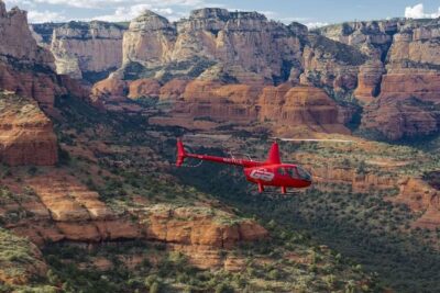
Mogollon Rim (80+ Mile) – Sedona Helicopter Tour
Read our review →
Secret Wilderness – 45 Mile Helicopter Tour in Sedona
Read our review →Browse the lists this tour appears in